
The interactive map needs WebGL. You can still select units, view floor plans and manage your shortlist.
Walking journey
Partial route · home, gate and destination joins and continuous shelter unverified.
Coverage breakdown · what is still unknown
Walking effort & source limits
Effort is described by walking duration and mapped route features. Fatigue, remaining energy, calories, elevation gain and accessibility are not predicted. Time excludes waits and does not model a stair-specific pace.
© OpenStreetMap contributors. This preview is separate from the 3D terrain; it does not establish walking levels or a complete sheltered route.
Places & facilities
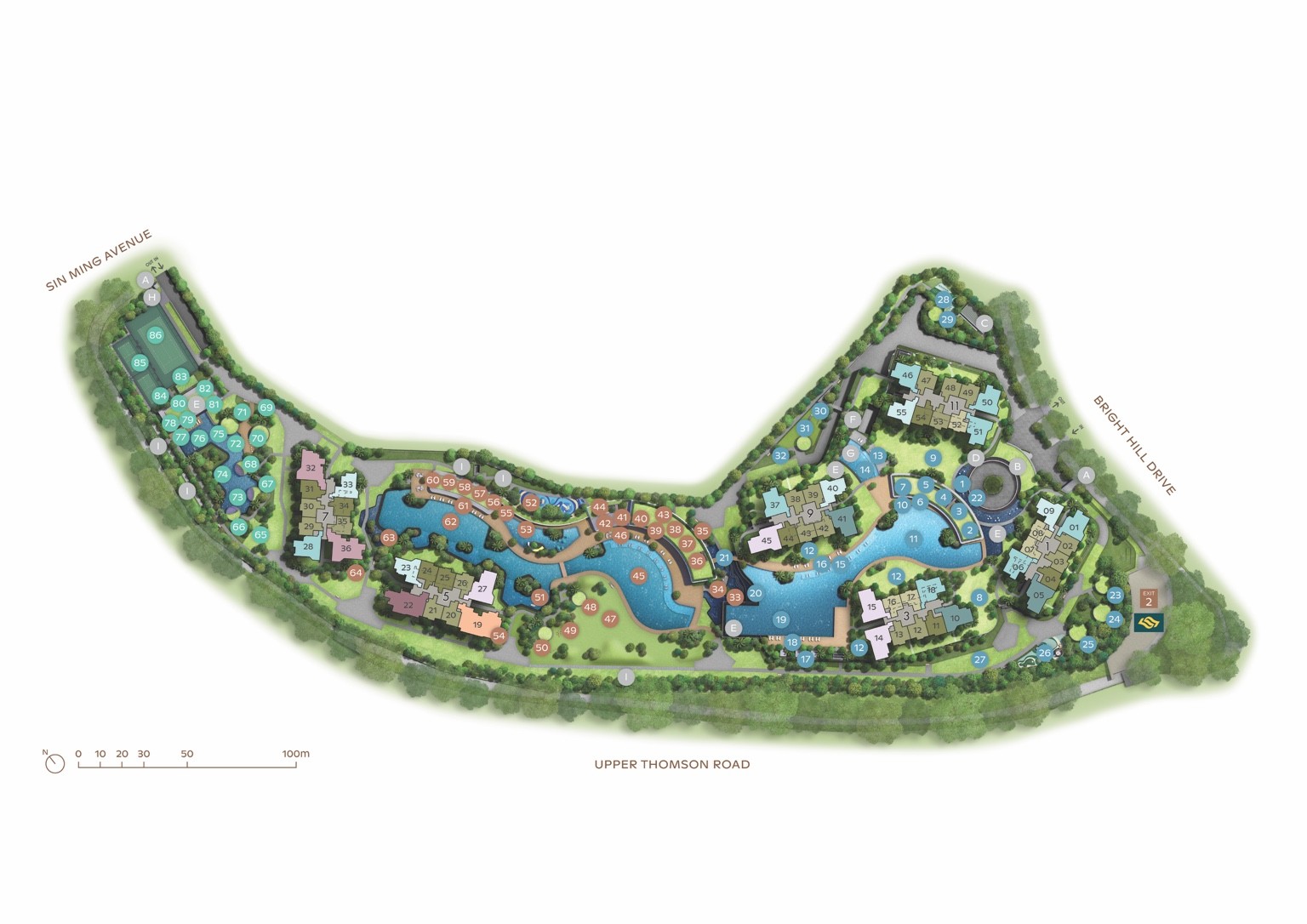
Facilities key · 1–86
Regional map · water and managed-area outlines.
Terrain and forest heights are unresolved. This does not confirm a reservoir view.
Entrance, shelter & sources
Two pedestrian gates: G1 at Bright Hill Drive and G2 at Sin Ming Avenue. Separately, vehicle access is at Bright Hill Drive (main) and Sin Ming Avenue (residents only).
Developer site plan ↗Access names and 65 m linkway: developer saleskit p79. Shelter is not inferred from Level 1 / Level 2 path colours.Layers
Brochure p84 ⓘ
Printed horizontal dimensions from Saleskit v2.0, page 84, between the indicated façades. Arrow positions follow the source diagram approximately; 3D guides are raised above roofs for clarity. These are not floor-specific or window-to-window privacy distances. Different arrows between the same blocks refer to different façades.
Map key
 Thomson Reserve
3D ripples are cosmetic; water levels unresolved
3D finish uses historical tree-cover cells; not measured trees
Tap a label for its name and details
Separate from vehicle access
Approximate route from the developer’s diagram
Colours identify different sources. Unknown shelter sections are hidden; a continuous sheltered walk is not confirmed.
15 OpenStreetMap points within 50 m of the site; records last edited in 2017. Heights, crown sizes and ground levels unknown; incomplete coverage.
Use Nearby places for school, shopping and MRT details. Private condo names appear within 500 m of the development boundary; landed-estate names are hidden. Labels appear as space allows. Place markers identify address points or named MRT exits, not estate boundaries.